






Buzz Solutions PowerAI
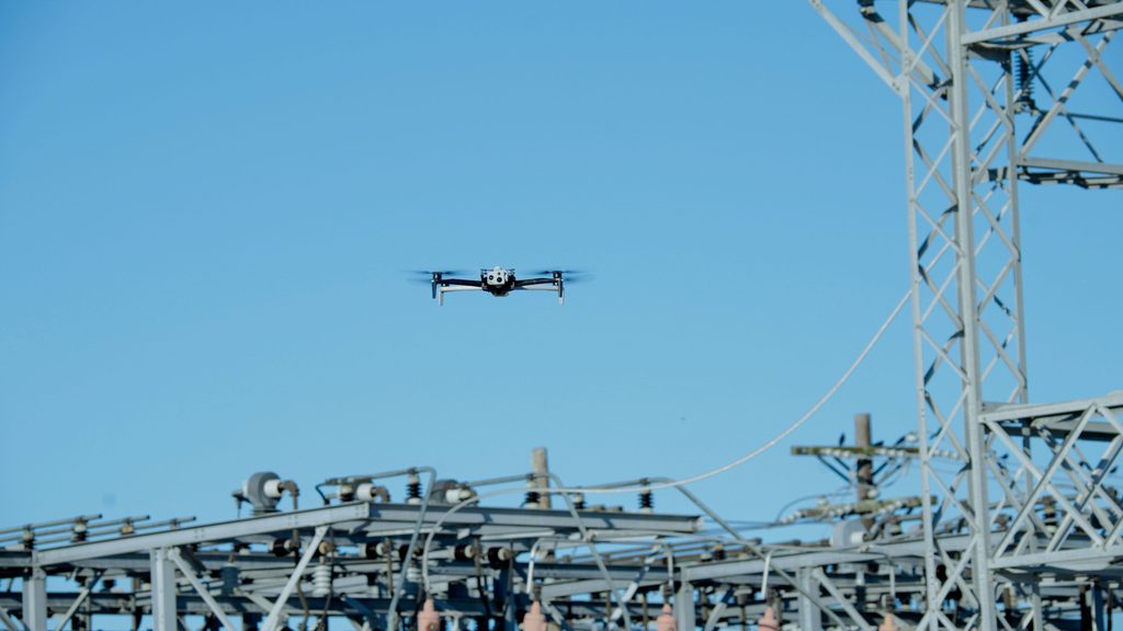
(Image: AEP via Buzz Solutions)
Unlocking the power of data
Peter Donaldson analyses how one company is revolutionising the gathering and interpretation of data for power sector utilities
Energy infrastructure inspection is a growing and potentially transformational application of UAVs and AI in synergistic combination. Buzz Solutions developed its own visual intelligence system, PowerAI, specifically to process inspection data gathered by UAVs and other platforms, identify and prioritise existing and incipient faults, and to integrate the information into utility customers’ established workflow procedures and software. The ultimate aim is to keep energy flowing reliably by enabling human experts to make better informed decisions and more timely repairs.
“We launched as a company to help utilities analyse their inspection data collected with drones, helicopters, fixed-wing aircraft, static cameras and ground-based rovers,” says Buzz CEO Kaitlyn Albertoli, who co-founded the company with CTO and COO Vikhyat Chaudhry. “At that time [2017], we recognised utilities were collecting a lot more data but they didn’t have a great way to manage, analyse and store that data and to turn it into actionable information.” Much of the analysis was manual, generating reports that may only have been looked at once, she notes. “The problem was that utilities were going from collecting thousands of images a year to collecting millions of images a year – not a scalable process with manual analysis.”
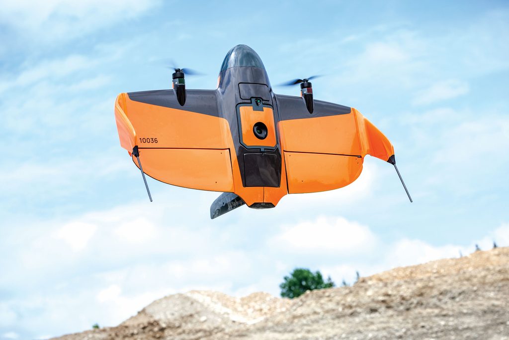
Beyond providing the AI software, Buzz also advises utility customers on drone operations and even selection of particular drone types, which is heavily influenced by the intended outcome and how this relates to the strengths and weaknesses of different drones. She notes, for example, that Skydio’s multi-copters are great at obstacle avoidance, which enables them to get up close to a structure and gather finely detailed images, but their range is not as great as that of a fixed-wing machine such as a WingtraRay. A key part of the conversation with a new customer is striking the right balance of speed, efficiency and accuracy for what they want their programme to achieve.
Unlocking silos
Often, different departments within utility organisations have collected datasets for different purposes by different means. If that data then sits in silos, value beyond its original purpose is locked away from other departments – value that PowerAI can unlock. For example, Albertoli recalls that one utility customer had used a helicopter to collect forestry data to assess potential encroachment by tree growth onto its network of power lines, in the process taking pictures of all the towers. “So, we were able to help the utility make use of that forestry dataset to identify all of the insulators and their material types on tens of thousands of structures. We were also able to tell them – over the next six years – where they needed to paint the towers to prevent rusting.”
(Image: Wingtra)
For a utility just beginning to build a data library for future trend analysis, drones provide the means to collect vast numbers of images quickly and at low cost. Taking full advantage of this capability often requires a change in mindset. “When we first start to engage, utilities are often just collecting images of defects. They’ll fly to thousands of towers and only take a picture when they see a defect, and that might not be on every tower. We see that as a missed opportunity,” she reports. “If they don’t take images of the good components, they won’t have a baseline to start from.”
Even when data exists, barriers to sharing it with Buzz for analysis have to be overcome, such as getting it through firewalls, uploading to utilities’ own cloud infrastructure or sharing it internally. “Typically, we’ll include data management in early conversations prior to our implementation process.”
Albertoli stresses that Buzz recognises the utmost importance of cybersecurity to utilities. The company employs end-to-end encryption and secure cloud environments, and works within the Systems and Organizations Control 2 compliance regulations – rules designed to provide auditors with guidance for evaluating the effectiveness of organisations’ security protocols.
“We have a multi-candidate approach where every utility’s data stays in its own tenant instance,” she says. “We work through the full risk assessment process with them to make sure that their data remains secure, uncompromised and that only the right users have access.”
When the algorithms have data to work on, they quickly lead to proactive maintenance that directly prevents costly outages, often through detection of damage during component condition assessments. For power transmission lines, that may be damage to cross arms, rusting structures, white insulators with dark marks that indicate they have experienced flashing or overheating transformers, for example.
While Buzz’s software keeps humans in the loop by flagging up things that need their attention, it saves vast amounts of time by automating formerly manual analysis, eliminating duplicative inspections by different field teams, and freeing experts such as field technicians, pilots and engineers from the need to draft reports and manually enter data.
Soothing trepidation
Albertoli reports that utilities often express trepidation towards employing an advanced analytic solution and increasing inspections because of all the work it will reveal that must be done. However, by having an efficient process, she argues, they can start chewing through a lot of that backlog, modernise the grid faster, prevent outages and reduce risk. “That’s huge, especially when you’re looking at storms and wildfires, when time is of the essence.”

Buzz’s algorithms are exposed to enormous quantities of non-standardised data from diverse sources, yet must ensure consistent detection accuracy across different sensors, resolutions and lighting conditions. The data’s variability is addressed by putting it through a multistage normalisation platform designed specifically for aerial inspection data.
Chaudhry explains that this includes geometric normalisation (camera calibration and perspective correction), radiometric normalisation (colour balancing and exposure correction) and resolution harmonisation to ensure consistent feature representation across datasets. “We also standardise metadata [altitude, sensor type, capture angle] and incorporate augmentation strategies that simulate real-world variability, such as lighting changes or motion blur, so the models generalise well across platforms like drones, helicopters and fixed-wing aircraft,” he adds. “This combination allows us to maintain consistent detection performance, even when input conditions vary significantly.”
UAVs differ enough among themselves to be major contributors to data variability. Broadly, fixed-wing types generate high-volume, lower-resolution datasets compared with the high-detail, close-range output acquired using multi-rotor VTOL drones – although the performance envelope of both VTOL and conventional drones and their sensors is expanding rapidly. Chaudhry says that the AI adapts its analysis based on both explicit metadata such as sensor type and altitude, for example, and implicit learned features such as scale and texture density. For lower-resolution, wide-area datasets, such as those generated by fixed-wing flyovers, the system emphasises coverage and coarse detection while identifying components and large anomalies. For high-resolution drone imagery, it performs fine-grained inspection, including micro-defect detection and condition assessment. “Rather than requiring separate workflows, the models are trained to operate across scales, with internal representations that allow them to ‘understand’ the context of the data and adjust sensitivity and thresholds accordingly.”
(Image: Skydio)
In terms of sensors, PowerAI supports RGB and thermal data as a baseline, and can extend to Lidar and other sensor types if required by the use-case, according to Chaudhry. He notes that fusion happens at multiple levels, with early-stage alignment ensuring spatial correspondence between sensor images, while feature-level and decision-level fusion combine complementary signals. “For example, a visual anomaly like surface damage can be cross-referenced with a thermal hotspot to increase confidence in identifying a fault,” he explains.
Structured model development
Training AI is an open-ended process and, as it expands its operations, Buzz needs PowerAI to identify components and faults it has not previously encountered. For this, it follows a structured model development lifecycle that starts with the collection of a representative dataset that captures variations in appearance, environment and capture conditions. Chaudhry again: “While the exact volume depends on complexity, diversity is more important than sheer quantity by covering different angles, lighting conditions and asset states. We then use transfer learning techniques to adapt existing models, followed by iterative validation with human-in-the-loop review. This allows us to reach high-confidence performance relatively quickly while maintaining robustness.”
Automatically deciding what is and is not evidence of a fault can also be challenging – the results of electrical ‘flashing’ can be hard to distinguish from shadows, for example. In tackling such ambiguity, PowerAI combines spatial, temporal and contextual cues. “Instead of relying solely on pixel-level differences, it evaluates texture continuity, edge characteristics and consistency across frames or adjacent captures,” Chaudhry explains. “It also considers the physical context, such as the expected geometry of insulators and the typical locations of faults.”

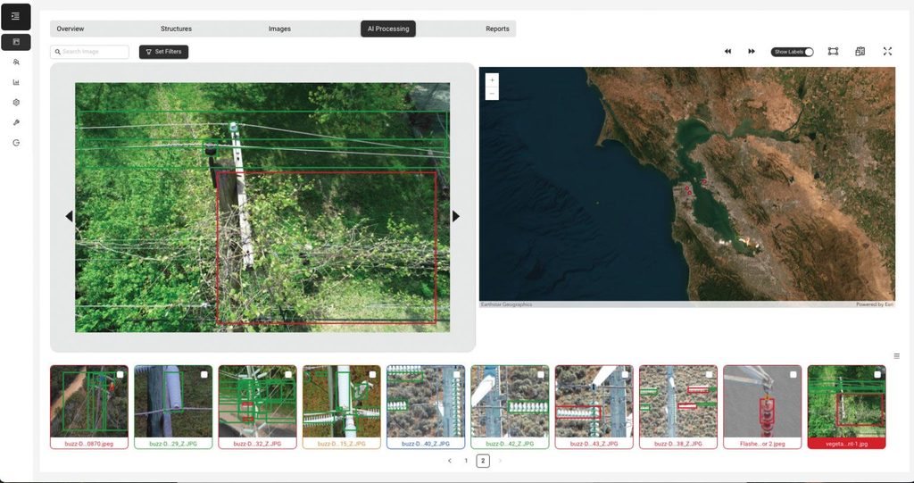
Every detection of a fault comes with a confidence score. This score is derived from model probabilities and calibrated with validation datasets and real-world feedback. Chaudhry notes that these scores are continuously refined to reflect operational performance. To balance automation efficiency and reliability, confidence thresholds determine workflow routing, he adds, in that high-confidence detections can be automatically ingested into systems, while lower-confidence ones are flagged for human review.
Identifying components and assessing their condition are separate but closely related tasks, for which PowerAI deploys a modular architecture of specialised models. One set handles component detection and localisation, while another assesses condition or defects, Chaudhry says. This separation allows each model to be optimised for its task, improves interpretability, and makes it easier to update or extend capabilities.
Reasoning & priorities
The AI uses contextual reasoning as a key differentiator. It models spatial relationships between components – so if a broken insulator is detected, the system automatically evaluates nearby conductors, attachment points and structural elements for secondary damage. “This mirrors how human inspectors think, but at scale and with greater consistency.”
Transforming a simple identification (such as ‘rusted bolt’) into a prioritised one involves combining defect severity, asset criticality and operational context. The system considers the component’s function, its position in the asset hierarchy and the potential consequences of failure. This produces risk-based insights that align with utility maintenance priorities.
‘Regional intelligence’ is incorporated through both data-driven learning and configurable logic layers. Models learn patterns from historical data (like how defects behave in specific climates), while configurable rules let utilities adjust prioritisation based on local policies or risk tolerance – a hybrid approach designed to ensure flexibility across regions.
The system also integrates information from other sources – such as weather patterns, wildfire risk maps and grid load data – via Esri ArcGIS layers. For example, defects in high-risk wildfire zones may be escalated. “This helps utilities make more informed decisions by combining visual insights with operational data.”
Trend analysis & predictive maintenance
By aligning datasets across time (a 2022 helicopter survey and a 2024 drone inspection for example), the AI quantifies degradation trends – measuring corrosion growth or crack progression. These trends are used to estimate deterioration rates, which can be extrapolated to predict when a component may reach a critical threshold, enabling a shift from reactive to proactive maintenance.
The next frontier is probabilistic predictive maintenance, Chaudhry explains. “By combining visual degradation trends with external factors, such as environmental conditions and operational data, we can estimate the likelihood of failure within a given time horizon.” Moving from identifying existing defects to anticipating future risks in this way enables more strategic and cost-effective asset management.
Workflow integration, actionable output
The technical journey of a single image is largely automated. It begins with capture by a camera onboard a UAV, for example, followed by ingestion – automated upload and preprocessing. In AI analysis, models process the image, then human oversight applied selectively based on confidence scores provides validation, after which it is pushed into enterprise systems such as SAP, Maximo and Esri ArcGIS.
SAP and Maximo are asset- and work-management platforms used widely by utilities, with a roughly even split between them. Some utilities run their own proprietary systems they have built for themselves. Most also use GIS from suppliers such as Esri. Albertoli emphasises that integration with all of these systems is key to the adoption of new technologies and products such as PowerAI.
(Image: Buzz Solutions)
(Image: Buzz Solutions / Ameren)
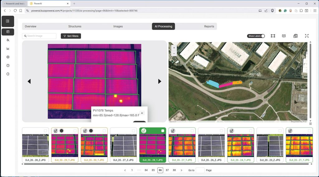
Actionable output for field crews is designed to be directly useful in that each issue includes a clear description, severity level, precise location and annotated imagery highlighting the defect, Chaudhry says. “The information is structured so it can be seamlessly integrated into existing utility workflows, enabling field crews to quickly understand and act on the findings,” Chaudhry further notes.
Uncertainty is explicitly communicated, with low-confidence or novel detections flagged for review, ensuring that critical issues are not overlooked while minimising unnecessary interventions.
Ground truth from field crews – confirming or correcting AI findings – is critical feedback, he emphasises, and is injected into the system to refine models and recalibrate confidence scoring. “Over time, this continuous learning loop improves performance and adapts to the specific characteristics of each utility’s assets and operations.”
Evolution toward the edge
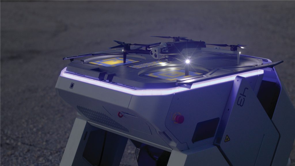
Buzz is increasingly distributing intelligence between edge and cloud computing – a hybrid architecture designed to balance speed, scalability and accuracy. Time-sensitive detections, such as smoke, fire and safety risks, are processed closer to the data source – on drone-in-a-box systems or fixed cameras, for example – to enable near-real-time alerts. More computationally intensive tasks, such as trend analysis and model training, remain in the cloud.

The long-term vision is a fully automated inspection-to-action pipeline, according to Chaudhry. “A drone-in-a-box system could perform scheduled inspections, detect anomalies in real time and automatically generate prioritised work orders integrated with enterprise systems.” Future development could extend to pre-ordering replacement parts from inventory, although human oversight remains important for validation and governance.
To prevent ‘algorithm drift’ as more utilities with unique asset types and regional challenges are added, Buzz maintains strong data isolation and controlled training pipelines. Models are designed to generalise across environments while allowing targeted adaptation to specific customer datasets, ensuring that improvements benefit the broader system without degrading performance for individual clients, he says.
This approach moves utilities from reactive inspections toward a predictive, data-driven maintenance paradigm that improves reliability, safety and operational efficiency.
Automating solar inspection
St Louis-Missouri-based power company Ameren makes a good case study, having adopted Buzz Solutions’ PowerAI to assist inspection of its solar farms, with a fleet of drones used as sensor platforms. The company has set itself a goal of net zero carbon emissions by 2045 and is investing in a cleaner generation mix in this pursuit. This includes growing its solar capacity from a recent baseline of 510 to 2500 MW by 2030. The rule of thumb is that solar farms cover 4.5 acres per megawatt, so its 2500 MW target requires it to build and maintain infrastructure across an extra 8955 acres.
The company is developing a streamlined inspection process in which PowerAI processes drone imagery to detect visual and thermal anomalies, such as hotspots, string outages, cracks and dirt. These defects are mapped to GIS locations so that maintenance crews can find the affected panels. The solution includes a customised interface for Ameren and configurable reporting. The output from PowerAI integrates with Skydio Cloud and Esri ArcGIS, and also includes an API enabling custom integrations for work order systems.
Early results are very positive. As well as enabling identification of below-par panels and faster performance restoration, the system also finds more issues with panels while they are under warranty, Buzz reports. Furthermore, Buzz estimates labour cost savings of between $175,000 and $285,000 per megawatt, based on requiring three to five business days to analyse RGB and thermal images for 7 MW of solar capacity. Other savings include reductions in outage costs of 20–40% – including fewer truck rolls – and more than 75% in the duration of inspections.
The application of AI – and drones – at Ameren goes far beyond solar farms. James Pierce, manager for UAS operations and inspection services, says that AI is becoming an important part of how the company inspects and manages its infrastructure. “Rather than using it as a standalone technology, we are working to integrate it with drones, GIS, deep learning, digital twins and reality capture to support inspections across electric transmission and distribution, gas operations, storage, generation assets and other areas.”
AI is a good fit with drone inspections in particular because of the sheer volume of imagery they generate, he confirms. “AI can analyse that data, identify potential issues and provide our teams with information they can act on. That gives us a stronger foundation for maintenance planning, improves situational awareness and helps support a more resilient grid; all the while making the best use of existing resources and human capital.”
Seasoned operator
Ameren has been operating drones for more than a decade, starting a pilot programme in 2015 that became a fully operational enterprise programme in 2017. In those early years, Pierce recalls, the focus was simply on understanding where drones could safely add value and how they could fit into utility operations. The programme’s scope has since broadened well beyond image collection, and it now supports multiple business units under a centralised model with common governance, cybersecurity, safety standards and data management practices.
The company’s AI journey started in the same time frame as its drone programme. “My team started building AI models in 2017 in-house to identify defects on electric distribution level, 2–69 kV assets,” says Pierce. “We accumulated over 30 working models, but soon outpaced hardware, leaving us to put development on hold. One approach in the current environment is to partner with companies like Buzz Solutions and Esri to help us customise our workflow and work within the ever-changing AI landscape.”
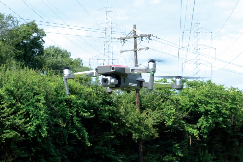
Ameren operates a variety of drones, many of which are available off the shelf from enterprise drone dealers, equipping them with combinations of high-resolution visual cameras, thermal imagers and Lidar. The sensor choice depends on the asset being inspected and the type of information needed. “The aircraft itself is only one part of the process. The quality of the data and how that data moves through our inspection workflow is what really matters to end users,” Pierce emphasises. “We subscribe to the ‘garbage in, garbage out’ philosophy, so we only use the highest-quality devices with the broadest inspection potential to preserve data quality.”
The integration of AI into Ameren’s existing systems is a work in progress. With respect to solar farm inspections, the system already flags equipment conditions and potential faults, all correlated with GPS coordinates, asset details and panel identifiers etc, making it easier for crews to locate and respond to issues. “Once the process is fully developed, we want inspection results to feed into our enterprise GIS so we can monitor asset health over time and support additional activities like vegetation management, storm response and infrastructure resiliency.”
Pierce confirms that AI is impacting the scale and speed at which inspection data can be reviewed. “Manual review of thousands of images takes considerable time. AI can process that same imagery much more quickly, identify potential issues and organise findings based on priority,” he says. “Our inspection teams can then focus on confirming those findings and determining the appropriate maintenance response instead of spending their time searching through imagery.”
He also emphasises that the technology itself is only part of the transition to AI-enabled drone inspection. Ameren also had to establish the governance, data standards and secure workflows needed to support AI across the organisation, while supporting the inspection workforce through its introduction.
Human expertise remains
“Because AI is intended to be incorporated into our existing inspection process, the focus cannot be asking people to work differently. It continues to be about giving them better information within the workflows they already know,” Pierce says. “Engineers, inspectors and other workers still apply their expertise to evaluate AI’s findings, determine whether maintenance is needed and decide what action to take.”
Successful implementation requires collaboration across operations, IT, cybersecurity, legal and senior leadership to ensure that the technology can be introduced in a practical, safe and consistent way.
(Image: Buzz Solutions / Ameren)
Ameren regards AI as a capability that will continue to grow alongside its inspection and asset management programmes. The company continues to expand its AI-powered inspection workflows, reporting, photogrammetry and data integration. It is also working to reduce the time between collecting inspection data and getting useful results to crews. “The long-term goal is to deliver prioritised findings while teams are still in the field so they can make decisions faster.”
Enabling its drone operations, Ameren now has nationwide BVLOS waivers under US FAA Part 107 regulations. As a result, Pierce reports, its datasets are growing exponentially. “We continue to watch the evolution of BVLOS regulations, which promises to reduce restrictions further and unlock more possibilities for us. As those regulations ease and mature, they’ll create additional opportunities to expand how drones and AI support infrastructure inspections and grid operations.”
Looking to the future of infrastructure inspection more broadly, Albertoli anticipates inspections being continuous, proactive, precisely targeted and integrated into daily operations – and with the drone-in-a-box concept playing a major role. “Drone-in-a-box solutions are a huge advantage for utilities because they are able to operate multiple drones at the same time from an operations centre,” she says. “We see that the ability then to analyse the data seamlessly and push the insights into the hands of relevant stakeholders quickly is where utilities can make better decisions.”
Some key suppliers of compatible systems
Esri: ArcGIS geospatial information system
Maximo: enterprise asset management software
SAP: enterprise software and cloud computing
Skydio: Skydio Cloud cloud-based drone management software
UPCOMING EVENTS